We have had a wonderful week in Boulder visiting with Mike and Nicole. Dick was able to complete some essential bicycle tasks: 3 new tires, truing the wheels and installing a new cycling computer on my bike.
Early one morning, Dick went with Mike to do some rock climbing before Mike went to work. Mike did the climbing, Dick did the belaying.
Nicole is learning how to use her new letterpress. You can follow her artistic adventures at http://bluebicicletta.wordpress.com/.
Mike and Dick rode to Golden CO to visit the American Mountaineering Center one day:
Mike and Nicole, thank you so much for letting us stay with you, for all the delicious meals you cooked, and for your company. Spending time with family is one of the joys we never get enough of.
Thursday, August 11, 2011
Saturday, August 6, 2011
Around town
After breakfast we rode our bikes to downtown Boulder. There are so many bike paths, you hardly have any street riding.
On to the University of Colorado where Mike is doing post-doc research for the next two years or so.
If he works at his desk and leaves the door open, when he turns and looks out, he can see
the Flatirons, a great rock-climbing destination:
In the lab, Mike checks one of his samples for progress:
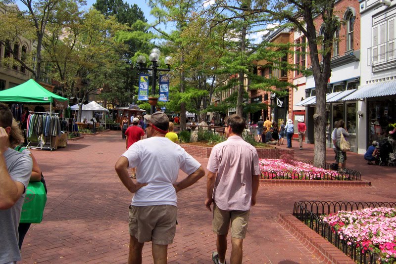
Pearl Street is a popular shopping and entertainment destination:
Congratulation to Nicole whose artwork is on display at the Museum of Contemporary Art:
Picnicking and tubing down the river:
It was amazing how crowded it was downtown.On to the University of Colorado where Mike is doing post-doc research for the next two years or so.
If he works at his desk and leaves the door open, when he turns and looks out, he can see
the Flatirons, a great rock-climbing destination:
In the lab, Mike checks one of his samples for progress:
Friday, August 5, 2011
To Boulder
Dick and I are opposites when it comes to preferred riding terrain. Today, Dick wanted to climb 2748 feet for 13 miles to the top of Loveland Pass at 11,998'. I was to pick him up at the top, no downhills for him, oh no.
Meanwhile I strolled the banks of Lake Dillon and watched a class painting plein air before heading out.
Here, he's almost to the top, one more hairpin turn to go:
There were a lot of tourists at the top, several gave him a round of applause.
We drove to Golden. The final 20 miles to Boulder were mine. SR-93 is a busy stretch of road.
We have arrived at destination #1, Boulder Colorado! This is the new home of Dick's younger son, Mike, and his wife, Nicole. Time for a little and welcome break.
Change of bicycle touring plans. As we sat in a coffee shop waiting for Mike to get off work, Dick said, "What if . . . we just keep riding east?" You mean, the mountain climbing would be almost over? Was I ecstatic? You betcha.
Miles = 1537
Thursday, August 4, 2011
To Dillon
The tent was a soggy dirty mess this morning. We packed up early and went to Subway for breakfast. Yes! you can get a $5 Footlong for breakfast too. It was nice to have a dedicated bike trail for the next 7 miles.
Without the AC map and its elevation profile, I thought it would be easy to ride 23 miles to Breckenridge. All of the "welcome to our town" signs in Colorado say nothing about population, but do tell you their elevation.
It wasn't an easy ride at all and when I came to a sign that said "Hoosier Pass, 11,532' - 4 miles," I was ready to cry (maybe I did cry a little bit). After Alma, I'd already been riding on a shoulderless road, with fast traffic that scared me. When Dick suggested we load the bike and skip this part, I was so relieved. In Breckenridge, we took a little break and I did some research at the public library since we weren't sure where the next campground was. Dick decided to take the day off (the news on Bloomberg radio was riveting!) and nothing but bike trails were ahead so I rode on. It's so nice to not deal with vehicles whizzing by.
The next 20 miles took me to Frisco then around Lake Dillon where recreation opportunities abound.
We camped at Prospector Campground on the other side of the lake. Frisco is in the background. Many trees have been cut down in this campground to hopefully control the pine beetle infestation.
Miles = 1504
Wednesday, August 3, 2011
To Horseshoe Campground near Fairplay
Beginning today, we went off the Adventure Cycling route to make our way north to Boulder. This means more research, usually online, to find campgrounds and other services. Tonight was going to be a bit easier because we planned to pitch our tent at the home of a friend who lives in Fairplay.
As I rode through the historical downtown of Salida, I stopped to look at a eye-catching store-front. An old man came up to me with a smile and a twinkle in his eye and said, "Bicycles are supposed to follow the same rules as cars and you're parked in a 'No Parking' zone." I smiled, apologized, and said that as a rule, I at least stop at all stop signs. "Oh, I do, too, and if I miss one, I always stop twice at the next stop sign. You have a good day now," he patted me on the shoulder, and went on his way.
Commercial raft trips are very popular in this area. There were many old school buses on the road today with or without passengers, all towing a trailer with 4-5 rafts stacked on top of one another.
Mt Antero, one of 53 "fourteeners" in Colorado. A fourteener (or 14er) is a mountain peak which exceeds 14,000 feet and has at least 300 feet of prominence. There are 546 fourteeners in the world, Colorado has the majority within the United States.
Heading for Fairplay as the afternoon clouds begin to gather:
Unfortunately, we did not make a connection with our Fairplay friend, so we drove very slowly for 7 miles down a washboard dirt road to Horseshoe Campground. It was about 7:30, the clouds looking more threatening, the mosquitoes swarming - I got the tent up as quickly as possible and got our bedding inside while Dick started dinner. The sky filled with lightning, the thunder rumbled and a heavy rain started. As it got dark, it also got quite cold. I huddled under the blankets to keep warm while Dick took refuge in the car in between stirrings of the pan. He was soaking wet by the time it was done, we ate inside the tent directly from the pan and shared one spoon, which was better than going back out in the downpour to find another one. One more trip to the car to put the leftovers inside since this is bear country. It was one of those nights that makes you appreciate the occasional motel and the days when there is no drama.
Miles = 1479
Tuesday, August 2, 2011
To Poncha Springs
The Gunnison River as it enters Blue Mesa Reservoir:
Farther upstream, just a few miles from Gunnison:
After about 3 hours of riding, I met Dick in the non-town of Parlin where he took over. The first 23 miles was a gentle grade with about 500 feet of elevation gain. From Sargents, however, the real climbing began. 10 miles to the top of Monarch Pass with an elevation gain of almost 3000 feet.
As Dick got ready for the downhill, there was an ominous cloud behind him:
Ahead, the lower white cloud was rising up from the mountaintop. The rain began to pour. He only made it a few miles before the spray from passing vehicles obscured his vision continuously.
I picked him up and we drove down the hill to Poncha Springs where there were no campgrounds, but there was a nice little motel which we took advantage of. The rain continued off and on for the rest of the evening.
Miles = 1421
Monday, August 1, 2011
To Stevens Creek Campground W of Gunnison
Looking back at Montrose as I rode out of town early in the morning.
Just a few miles up the road was SR 347, the turnoff for Black Canyon National Park. This canyon is unlike any of the many we've seen so far on this bicycle tour. It's 48-miles long, carved by Gunnison River which drops an average of 43 feet/mile (The Grand Canyon drops an average of 7.5 ft/mi) making it very steep and narrow, just 40 feet across at its narrowest point.
Back on the main road, I climbed to the top of Cerro Summit, not a big climb therefore I couldn't complain too much. Going down the other side:
We switched riding duties in Cimmaron. It was Dick's turn to climb. As you can see, sometimes the shoulders are very narrow. Trucks are almost always very courteous and move over as much as possible, RVs are the worst. Feeling a nearby whoosh from a too-close vehicle makes your heart skip a beat.
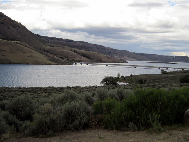
He had a great tailwind as he rode along Blue Mesa Reservoir in Curecanti National Recreation Area but those darkening skies brought a typical late-afternoon rain.
Stevens Creek Campground:
Miles = 1363
Subscribe to:
Posts (Atom)